Using The British Military Protractor for Map Reading
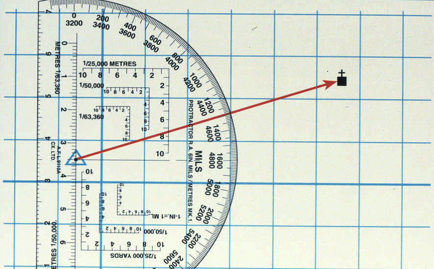
British Military RA Protractor
The British Military only use mils in navigation.
Using the RA protractor.
- The protractor should always be used when plotting grids and bearings.
- Always check the scale of the map and scale of the romer when plotting grids.
- Tape up the yard scale romer to avoid mistakes.
- Use a line of fine cord from the centre point when plotting bearings, a plumb line.
- Place the protractor over the map and align the northings and eastings with the zero lines and romer grids.
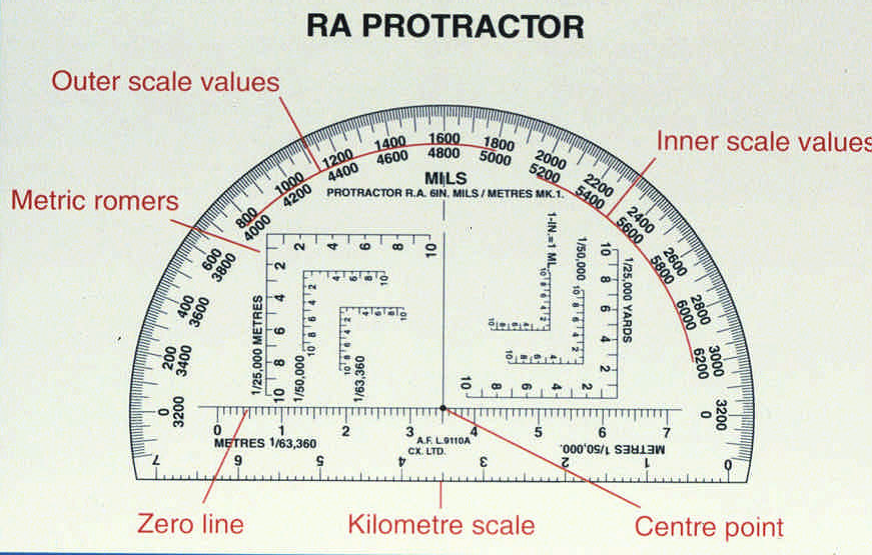
This is the issued protractor, the metres scale romers are on the left side, these are the romers that you should use.
Plotting Bearings
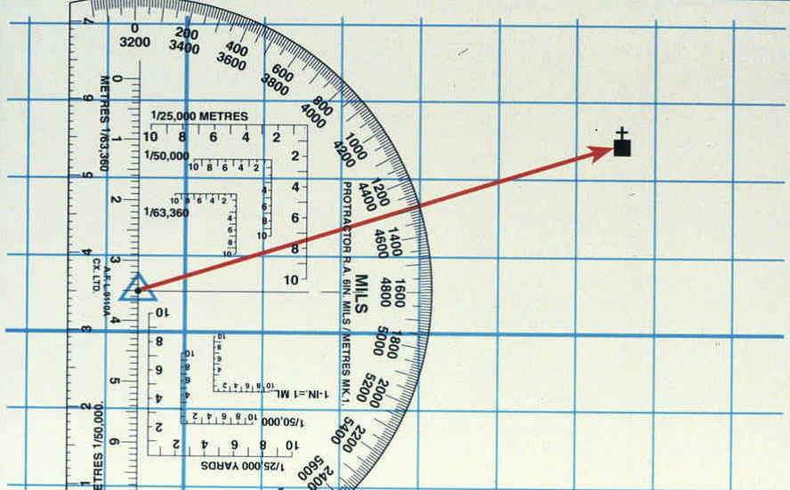
Ensure the map is on a flat surface, align the base line with the vertical lines on the map, the 0 should be in line with Grid North. All vertical and horizontal lines should be aligned with those on the map, overlay the centre point over your location on the map (trig point). Then draw a line or use a plumb line to draw a line from your location (trig point) to your target (church with tower). Where the line crosses the outer scale it indicates the Grid Bearing from your position (trig point) to your target (church with tower). The outer scale is used when plotting bearings East and inner scale for bearings West.
What is the Grid Bearing from the Trig Point to the Church?
Answer = 1300mils
To plot a backbearing from the church, turn the protractor to the left with the centre point over the church. Read of the inner scale and plot a bearing of 4500 mils back to the trig point.
Choose two points on a map and practice this procedure.
Metric Romers on the RA Protractor
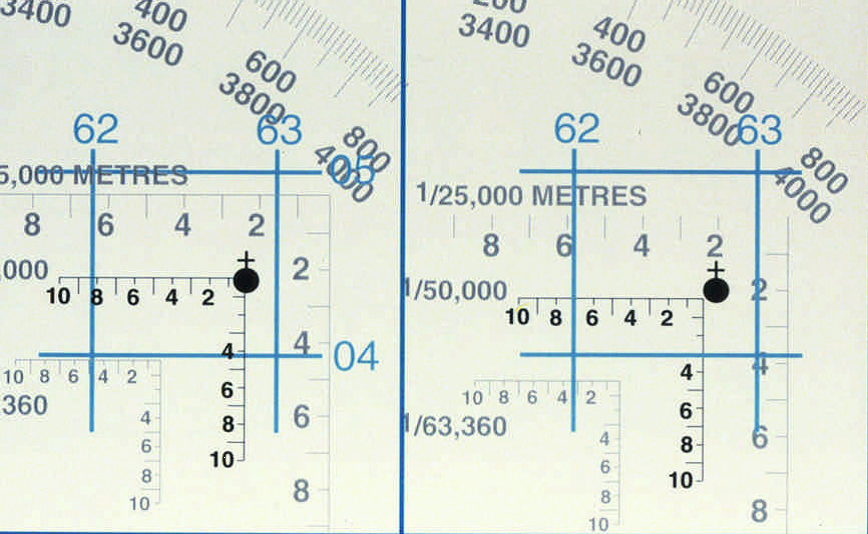
Plotting a grid using the 1:50000 scale romer on the RA Protractor.
EXAMPLE A GR 628044 EXAMPLE B GR 627043


